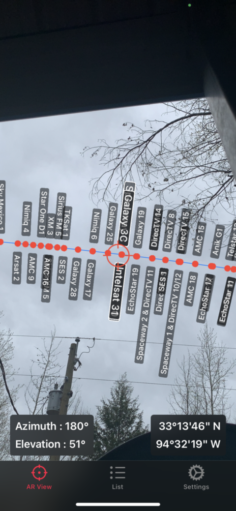
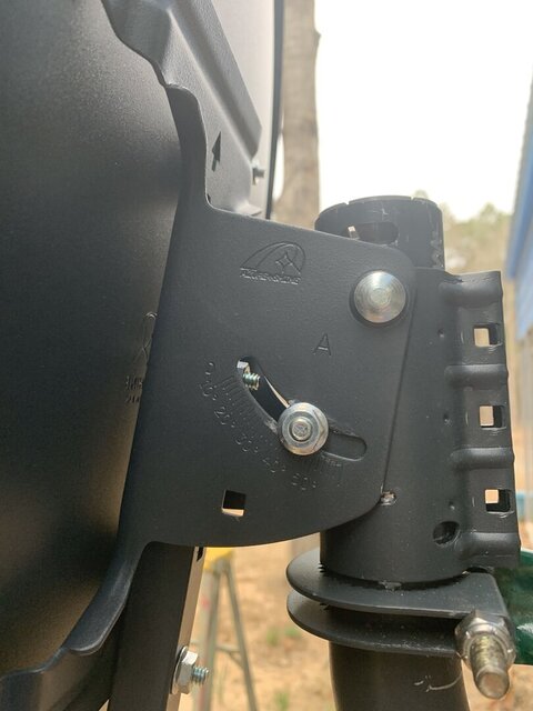
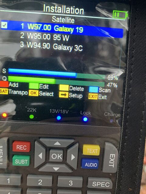
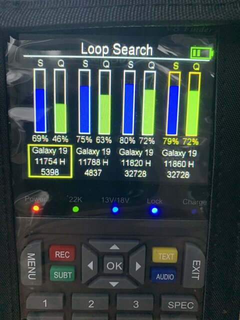
Okay I've started from square one. Mast perfectly plumb and locked down. Dish elevation set at 33. No motor. Trying to find Galaxy 3 C which shows at 94.9 on lyngsat. Entered lat and lon for location. Have slowly moved from due south to west. Same results. Nothing.
Confused
- Thread starter Texan61
- Start date
- Latest activity Latest activity:
- Replies 101
- Views 10K
You are using an out of date browser. It may not display this or other websites correctly.
You should upgrade or use an alternative browser.
You should upgrade or use an alternative browser.
There is nothing on Galaxy 3C (95w), go back to trying for 97W.Okay I've started from square one. Mast perfectly plumb and locked down. Dish elevation set at 33. No motor. Trying to find Galaxy 3 C which shows at 94.9 on lyngsat. Entered lat and lon for location. Have slowly moved from due south to west. Same results. Nothing.
Yes, and for 95W it should have been at 51.4 (not 33 as you have above).I should have dish set at 51.3? It's raining now so a lunch break is mandatory!
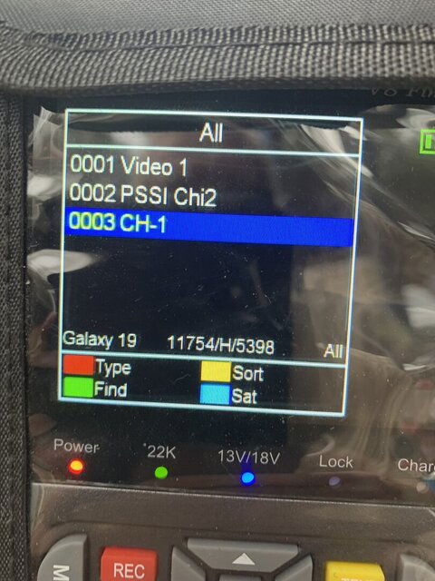
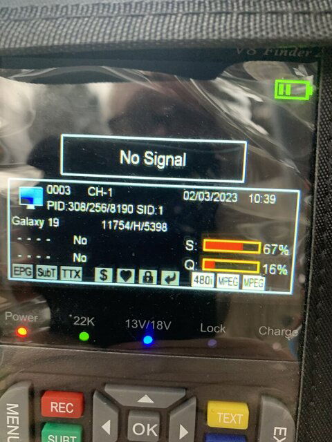
Dish set to 51.3 and seeing Galaxy 19. I had dish and motor set to my latitude and not satellite. DOH!!!
Dish set to 51.3 and seeing Galaxy 19. I had dish and motor set to my latitude and not satellite. DOH!!!
So you have acquired a signal on 97w?
Never heard of that, what is it?Where can I get a Walrus elevation adapter? Or someone have diy plans?
Walrus elevation adjustment is an add-on that is a 1/4-20 threaded bolt with thumb screw for fine tuning elevation adjustment as shown in motor setup tutorial on this website.
Well I'm close but no cigar. Had connection to a satellite that I had labeled 97 W but it once I scanned for channels there was only one and it was only vertical colored lines. I suspect that was actually 95 W. That was without motor. So I put motor back on mast and scanned and eventually found the same satellite. So then I programmed to go to 95 W and the motor returned to zero. I then programmed to go to 97 W and it moved west. Now I can't find anything and a storm blew in and it began to thunder so I'm done for today.
Well I'm close but no cigar. Had connection to a satellite that I had labeled 97 W but it once I scanned for channels there was only one and it was only vertical colored lines. I suspect that was actually 95 W. That was without motor. So I put motor back on mast and scanned and eventually found the same satellite. So then I programmed to go to 95 W and the motor returned to zero. I then programmed to go to 97 W and it moved west. Now I can't find anything and a storm blew in and it began to thunder so I'm done for today.
Well I'm close but no cigar. Had connection to a satellite that I had labeled 97 W but it once I scanned for channels there was only one and it was only vertical colored lines. I suspect that was actually 95 W. That was without motor. So I put motor back on mast and scanned and eventually found the same satellite. So then I programmed to go to 95 W and the motor returned to zero. I then programmed to go to 97 W and it moved west. Now I can't find anything and a storm blew in and it began to thunder so I'm done for today.
What was the frequency, polarity and symbol rate of the channel you were able to receive (color bars)? We can use that to see where you actually were pointed.
Walrus elevation adjustment is an add-on that is a 1/4-20 threaded bolt with thumb screw for fine tuning elevation adjustment as shown in motor setup tutorial on this website.
Give this a try. Member here came up with the idea almost a decade ago.

Ku Band setup/tune-up tool\aide
I have Geosat's 90cm Ku band dish and fought with it when setting the elevation. By hand it either was to much or not enough, or needed three hands. I finally came up with this and it works fine for me. Of course your mileage may vary. It consists of two (2) turnbuckles and one (1) 3 1/2...
If you get actual channels you can check against lyngsat listings. But for some, you may have to ask. I checked against my listing in my satellite receiver (none of the transponders you listed are on lyngsat as one is a feed and the others are data transponders).Thanks! How can I tell? I'm on the opposite side of south than I realized!
The transponders shown in the screen-shot are on 101W.
Since you are on 101w you only need to move your dish 4 degrees east and adjust the elevation a bit to get to 97w but mark your dish azimuth and elevation on your pole with a pencil or something before moving to 97w so you have a reference point to return to if you get lost.
Similar threads
- Replies
- 8
- Views
- 2K
- Replies
- 20
- Views
- 2K
- Replies
- 6
- Views
- 1K
- Replies
- 8
- Views
- 2K
- Replies
- 4
- Views
- 2K
Users Who Are Viewing This Thread (Total: 0, Members: 0, Guests: 0)
Who Read This Thread (Total Members: 98) Show all
- Texan61
- sanpat
- primestar31
- Tunacaptain
- VintageMale
- a33
- polgyver
- wagonman76
- gms49ers
- cyberham
- catdog1963
- Brct203
- mikekohl
- Gulcher
- ken2400
- one_db_compression
- bigg t
- DRCars
- Elsguy
- lonelyfool123
- stecle
- Mr_Dc2tracker
- Titanium
- waylew
- clucas
- ancient
- juventusbrown
- catamount
- osu1991
- armadillo_115
- Rainman21
- N5XZS
- orac
- kofi123
- mc6809e
- Keith Brannen
- Jim S.
- Hyper Casey
- Comptech
- FTA4PA
- phlatwound
- stonemountain
- TRG
- RimaNTSS
- johnr475
- MattFL
- JSheridan
- KE4EST
- badhat
- Long Hair
- thomasjk
- rgk
- JFOK
- dweber
- dfecarter
- W6MMS
- Lee60
- Timewave
- The_Toy
- brice52
- KaptainRandom


