Getting the Azimuth

4311wade

SatelliteGuys Family
Original poster
Pub Member / Supporter
Jul 25, 2021
116
69
Charleston West Virginia
Ok,
What’s the general consensus on setting the Azimuth for dishes big and small?
Smartphone apps? Or quality Compass?
And while I’m asking what’s the best way to get Elevation? The scale on my new KU band dish is not accurate… digital angle finder? Smartphone app?
Any advice will help.
 
All of the above. I use free downloadable apps on my Android smartphone which I search for in the Play store. But they are notoriously inaccurate. So you need to cross-check results across several different tools. A good old physical compass is useful for azimuth too. Remember to understand the difference between magnetic and true compass directions. You need to know the magnetic declination when using a compass at your location.

For elevation, I use a digital angle app. I place the smartphone against the front of the dish face edge. This can get you within a degree or so. Ultimately, these tools just get you in the approximately correct azimuth or elevation. Then it's up to you to slowly (jerkily?) move the dish in very small increments, pausing between each move, in azimuth and elevation while monitoring the strongest transponder frequency that you know is active on the satellite of interest.
Thank you for the reply!
 
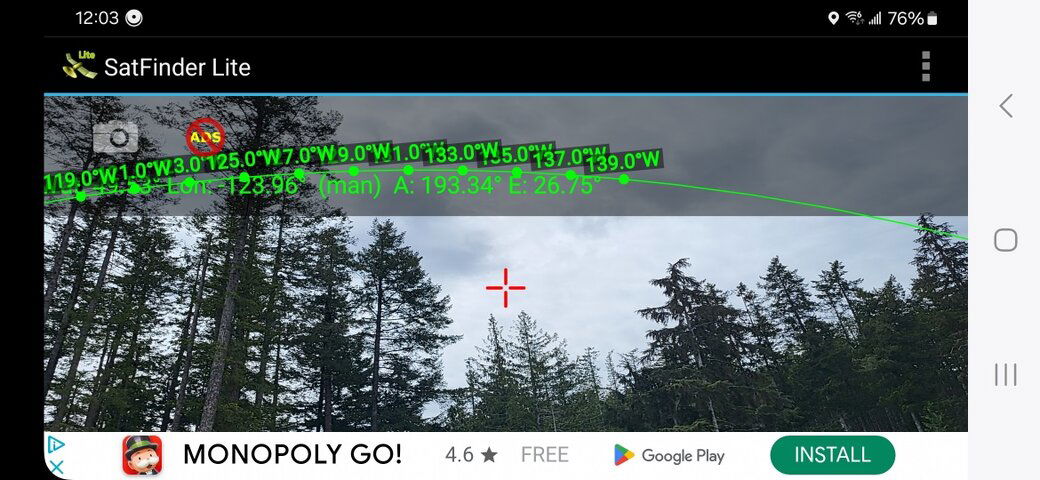
I like the apps called SatFinder Lite and Satellite Director on my phone. The first uses augmented reality to allow you hold your smartphone to the sky and "see" the satellite arc on your phone. Again, these free apps aren't the most accurate but they give a sense of what satellite you can receive.

Augmented Reality.jpg
 
  • Like
Reactions: 4311wade and arlo
For me. It's now entirely a digital angle gauge. For me anyhow. A Klein Tools from HD. Great for setting up elevation and declination angles and the tweaks needed to get a dish tracking correctly. A bit jealous now because mine reads to 0.1 degree. My circle dirt friends have one the same size that resolves to 0.01 degree.
As for azimuth. AR apps like Cybes showed work. If you don't mind jerkiness and the fact that figure-eighting your phone to calibrate it a lot is a pain. I find using them. You get a position one time and the next time you look, the sat moved in the tree line. But. Once you get that first sat located. A gooseneck type phone mount tightened on the dish 'someplace' movable and aligned to the sat you're aimed at will at least let you know if you are way out from finding the next one. All of this of course is for a polar mount setup.
 
I like the apps called SatFinder Lite and Satellite Director on my phone. The first uses augmented reality to allow you hold your smartphone to the sky and "see" the satellite arc on your phone. Again, these free apps aren't the most accurate but they give a sense of what satellite you can receive.

View attachment 171380
Thank you
 
Top