Intelsat 18 180.0E Ku

I get your point. There would no shadow on your dish from the LNB.
No, not what I meant.
Not so much as a shadow from the LNBF, the shadow from any trees or hills cast on the dish when the sun is in direct alignment with the dish on the worst outage day. ...
Exactly. Any ground not covered by shadow when the sun lines up with the satellite is a place where you can plant a dish to receive the satellite.

... At 5:22 PM I saw a large section of my backyard bathed in sunlight. Just have to decide if I want to move my 1.2 meter dish there.
 
...Any ground not covered by shadow when the sun lines up with the satellite is a place where you can plant a dish to receive the satellite.

... At 5:22 PM I saw a large section of my backyard bathed in sunlight. Just have to decide if I want to move my 1.2 meter dish there.
Today wasn't a good day to try this since there were clouds obscuring the sun partially. On a clear day, I will check the yard near the end of the day when the sun is at about 13 degrees elevation to see what I can discover. 13 degrees elevation occurs around 5:30 pm local time. At that time, the sun's azimuth will be about 6 degrees to the west of Intelsat 18.
 
I started with satellite arc info, then printed off my yard in google maps, that was the most up to date. From there I drew in the limits of the arc I wanted to see.

For locating my dish, I put it so the tallest tree was due south at about 87w or so. And I could still get Alaska (at least when the beam was in my area). Plenty of room for the trees to grow over time, because they will. The dish ended up being about 120 feet from the house so I had to size my wiring accordingly but it’s been worth it.

I used a cheap little map compass, with a rectangular plastic frame. Taped to a yardstick. Compensating for magnetic adjustment. Sighting down the stick, I could pick a feature in the distance to line up with based on where I was standing.

For elevation, I used a plastic locking protractor set at the target elevation. With a digital level on the horizontal. These days I could just use a free phone app, zero it at the angle I want, and have it beep. Hold it against the yardstick and sight down it to see if everything will clear.

For actual dish alignment I first held the yardstick against the mount, with the compass at the far end so the steel didn’t interfere. For elevation I just held the angle finder against the mount. I actually was in the zone for 87w from the first try, bumping the dish brought in channels I already had scanned from the old house.
 
  • Like
Reactions: cyberham
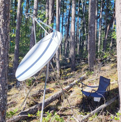
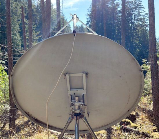
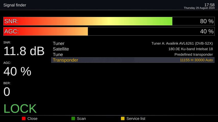
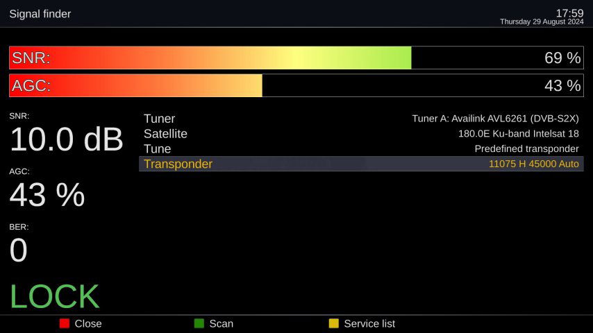
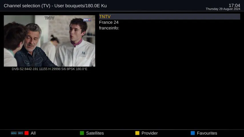
Today I had success. I used my 1.2m fixed dish mounted inverted to make the 12.8 degree elevation easier. My azimuth is 243 degrees (WSW). I had to locate the dish in the forest to find a window through the trees. In the end, I locked two transponders: 11155 H 30000 (11.5 dB) and 11075 H 45000 (10.0 dB). 11155 MHz has three video channels ITC (TNTV, France 24, franceinfo) and five audio channels. 11075 MHz has many video channels but all are encrypted with Nagravision.

My question to those who can receive this satellite either now or have in the past...do these polarities agree with your results? These disagree with Lyngsat which says both tps are vertical.

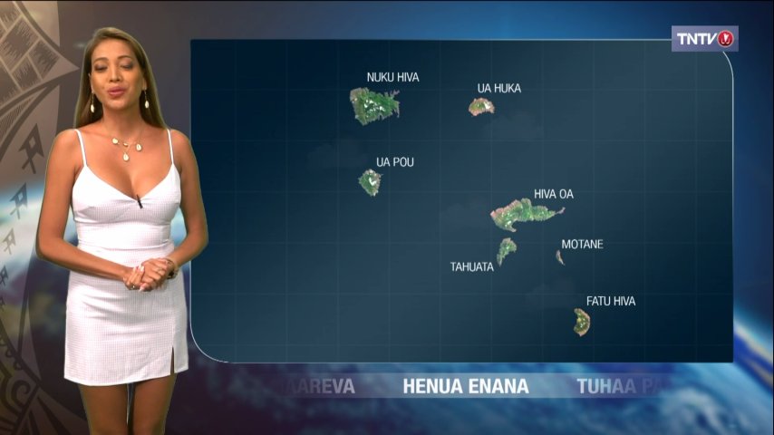
4ft_180E_1.jpg4ft_180E_2.jpg180E_11155H30000.jpg180E_11075H30000.jpg180E bouquet.jpgTNTV.jpg
 
According to SatStar.net, the beam you are in, French Polynesia/US, is only vertical:

How much skew is on the LNB? Since the dish is upside down, how did you adjust it, and did you go the right way?
Skew here is +35.3 degrees. With that amount of skew, if it were in the wrong direction, I wouldn't receive any signal. For an inverted dish, I learned last time I inverted that you turn the LNB in the same direction as if the dish is not inverted. The scale on my LNB bracket only goes to 20 degrees, so I do have to guess a little about where 35.3 degrees would be. I could try adjusting the skew a little next time I'm at the dish to see if this fixes the issue.

Six years ago, Martyn said here that he received both tps with H polarity. Are you around Martyn? I am doubting what I read about this satellite since I think there are errors in published info about Intelsat 18. Or maybe things have changed since the date those items were published.

ADDED: I'm wondering if they have combined the two 11155 tps into one tp. It looks like I am receiving everything that Lyngsat shows for 11155 V and 11155 H on the one tp. Would this save $$$ for them? And beam everything to both North America and the South Pacific?
 
Last edited:
I downloaded and zoomed in on the photo from the back of the dish, and can see the skew (judging by the coax connection/cable). To me, it looks backwards, and the skew should be on the other side of zero (from the back of the dish leaning like this / instead of \ ). Basing this on my fixed dishes, looking from the back.

Putting it to 35.3 on the other side, would change it to vertical.
I looked at high resolution old photos. I think you're right! This would explain my problem and the disagreement with satstar and Lyngsat. I will correct tomorrow! My most recent memory about an inverted dish was when aiming my fixed dish at 77W. Of course its skew is in the opposite direction of 180E.
 
Weird, Lyngsat shows 11155 as both V and H, on different beams.
I think now that Lyngsat is correct. We cannot receive the horizontal beam since it's focused on the South Pacific. We can only receive the vertical beam here in North America. I will correct my LNB skew today which will correct my scanned results to vertical only.
 
I think now that Lyngsat is correct. We cannot receive the horizontal beam since it's focused on the South Pacific. We can only receive the vertical beam here in North America. I will correct my LNB skew today which will correct my scanned results to vertical only.
Maybe, it's definitely below my horizon so I have no way of verifying anything. I just don't remember ever seeing the same frequency with both H and V polarities on the same satellite before.
 
  • Like
Reactions: cyberham
I think you're right!...
Keith Brannen gets the Troubleshooter's Award with full bragging rights associated. The LNB skew was corrected and both tps scan in on the correct vertical polarity.

Viewing from behind a dish, whether the dish is upright or inverted, a positive skew means you rotate the LNB clockwise. In general, with reference to the peak of the satellite arc, you always rotate the LNB in the direction of the arc which you are exploring: clockwise for western satellites, counterclockwise for eastern satellites.
 
Maybe, it's definitely below my horizon so I have no way of verifying anything. I just don't remember ever seeing the same frequency with both H and V polarities on the same satellite before

there is one that I can think of... Hispasat 30W5 has stuff on the Americas beam on 12052 H 27500 and on 12052 V 27500. Very confusing at first.
This situation is quite common on international C-band satellites such as 58 West, but it lost quite a few TPs during the month of August. It previously had several frequencies that were the same on both H and C polarity, for comparison purposes. Once you have relatively good signals from one frequency on H and another on V, and have achieved best quality or C/N reading in dB, there is an old trick that makes it even more precise. There is a spot on each polarity (should be 90 degrees out from the other) where nulling out a frequency from the opposite side creates maximum separation. This results in an even greater signal on each polarity, which is the best way to get maximum signal when encountering a frequency that is using both Horizontal and Vertical for two separate transponders. If you have a spectrum analyzer and look at the display, you will see a very sharp drop of the unwanted signal from opposite side when rotated to this precise spot. Otherwise, those using LNBFs that are not perfectly aligned in skew rotation will experience serious competition between frequencies used on both H and V. You will never get it right until you find that spot, and I was taught many years ago to create such a null to maximize the desired channels on each side. Good luck!
 
This situation is quite common on international C-band satellites such as 58 West, but it lost quite a few TPs during the month of August. It previously had several frequencies that were the same on both H and C polarity, for comparison purposes. Once you have relatively good signals from one frequency on H and another on V, and have achieved best quality or C/N reading in dB, there is an old trick that makes it even more precise. There is a spot on each polarity (should be 90 degrees out from the other) where nulling out a frequency from the opposite side creates maximum separation. This results in an even greater signal on each polarity, which is the best way to get maximum signal when encountering a frequency that is using both Horizontal and Vertical for two separate transponders. If you have a spectrum analyzer and look at the display, you will see a very sharp drop of the unwanted signal from opposite side when rotated to this precise spot. Otherwise, those using LNBFs that are not perfectly aligned in skew rotation will experience serious competition between frequencies used on both H and V. You will never get it right until you find that spot, and I was taught many years ago to create such a null to maximize the desired channels on each side. Good luck!
very good point, excellent advice! Thanks for sharing

and yes I forgot about those transponders on 58W, there are/were several like that, same frequency and opposite polarity. I think there are a few on 40.5W as well (Left and Right on same frequency in that case)
 
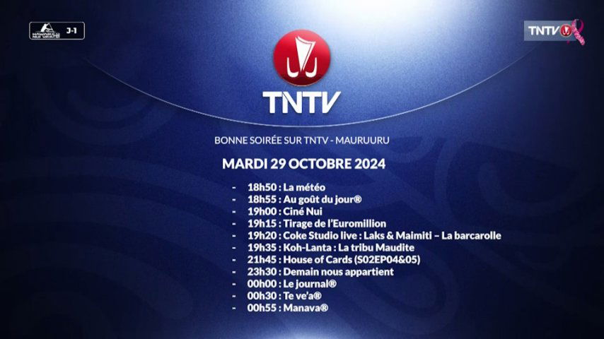
The ITC channels on 180E support EPG so it's easy to know as you view what's coming up on their schedules. I search for programs in Tahitian on the TNTV schedule since they may have a local reporter travelling around the islands providing most interesting visuals. I can record them and watch at any time.

Christian Lyngemark is updating Lyngsat with the info I fed him so the transponder with ITC channels that we can receive are being updated on his chart. There are many ITC radio channels also on two transponders.

If you can't receive direct from the satellite, you can always stream local programming from their website: Direct • TNTV Tahiti Nui Télévision.
 

(NOOB) How do I apply voltage to ku band lnbs?

Gtmedia V8 Finder 2

Latest posts