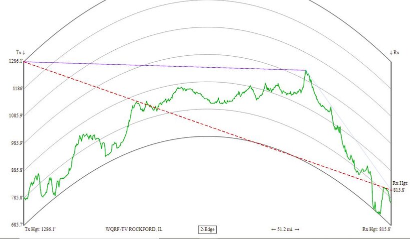
When I click on the distance from a TV station to my location, I get a graph that looks something like this. I looked on the RabbitEars FAQ and didn't see the answers. Can someone tell me what the red dashed line, the green line, the purple dotted line that changes to baby blue lines represent? And what does 2-edge mean? (or 1-edge for that matter - the ones that say LOS I assume are line of sight) And is the graph curved to represent the curvature of the earth?
I believe TX Height is the transmitting channel height above sea level, the RX Height is the estimate of where my antenna would be above sea level, the mileage is how far apart the two are. Those seem pretty straight forward.
Thanks in advance for any details you can provide!
I believe TX Height is the transmitting channel height above sea level, the RX Height is the estimate of where my antenna would be above sea level, the mileage is how far apart the two are. Those seem pretty straight forward.
Thanks in advance for any details you can provide!


