Hwboy4,and all others reading this..
I want to make it clear that I support Lucas Teske and the open satellite project. I tip my cap to him and the others that take hours to write all the code that goes into this stuff .
.
I am more then happy to provide this info as I have been in this position myself trying for find data on a subject.
To add to that, this is what makes it work, hobbyist and pros working together to make a product more accessible.
There are 2 big costs$$ to weather satellite data.
1. Physical hardware to capture the radio signals
2. Software, This one is more than hardware at times.
With the data becoming all digital the latter is a must to have.
As stated in post #1 hardware costs are coming down but software is still expensive. Commercial software for this could run into the 1000s of dollars and very well 10s,000s.
So the people like Lucas and the others out there doing this should be treated very well.
Most don't realize the lines and lines and lines X 1000s of code and time X days to make a computer ingest this stuff.
Computer code is not my fortae.
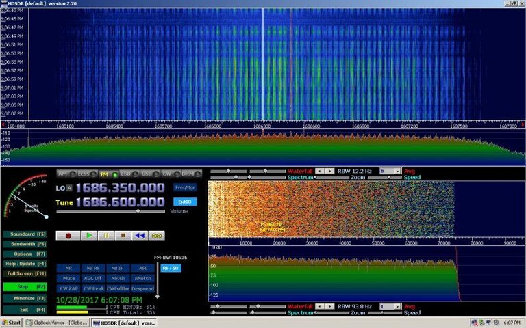
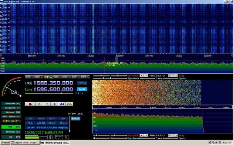
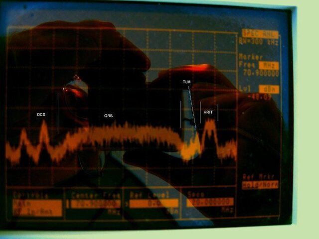
From what I see on the SDR the GRB signal is as strong as GVAR here and I get GVAR with 2 to 3 dB margin.
If I fall short it won't be by much and my 12' dish should make up for it.
A standard DVB-S2 board or IP output DVB-S2 receiver should be able to decode the outer layer of the signal.
Before NOAAPORT went to S2 I used a off the shelf PCI DVB card to decode it.
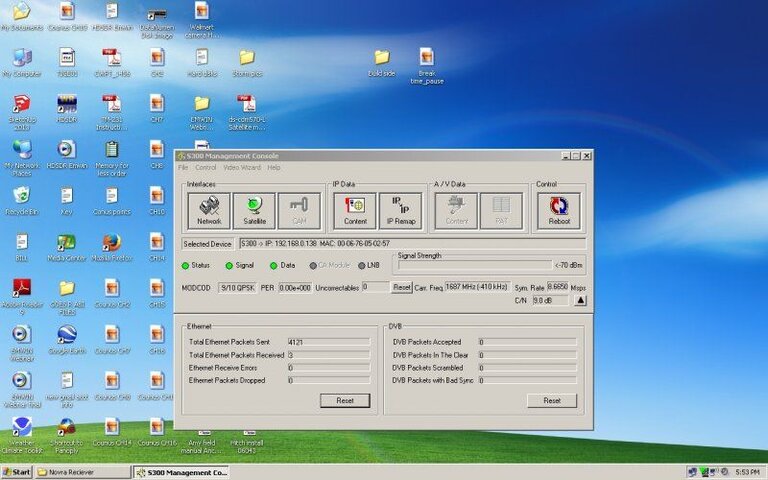
The receiver I will use is the NOVRA S300D.
The cheaper ones on ebay may work as long as it does IP data and has a reasonable S/N. Not shure how well the cheaper ones do.
The combiner should be here today so I'll I need to do is get the cables made up.
I have been holding out on this part until I got to this stage but I think it's time to put it out there.
As I stated in post #1 that the software is available for download so..
The Space Science & Engineering Center out of the University of Wisconsin -Madision has made the software for ingesting GRB and can be found here:
Community Satellite Processing Package for Geostationary Data
Not only will it ingest GRB it can do GVAR as well.
They also make a test package for the GRB data to use for checking the operation of the ingestor.
It's written for Linux Sp. 64 bit CentOS
Mabie Lucas and his fellow software developers of open satellite project may be able to use this, pass it along.
It's fully functional software.
I want to make it clear that I support Lucas Teske and the open satellite project. I tip my cap to him and the others that take hours to write all the code that goes into this stuff
 .
. I am more then happy to provide this info as I have been in this position myself trying for find data on a subject.
To add to that, this is what makes it work, hobbyist and pros working together to make a product more accessible.
There are 2 big costs$$ to weather satellite data.
1. Physical hardware to capture the radio signals
2. Software, This one is more than hardware at times.
With the data becoming all digital the latter is a must to have.
As stated in post #1 hardware costs are coming down but software is still expensive. Commercial software for this could run into the 1000s of dollars and very well 10s,000s.
So the people like Lucas and the others out there doing this should be treated very well.
Most don't realize the lines and lines and lines X 1000s of code and time X days to make a computer ingest this stuff.
Computer code is not my fortae.
From what I see on the SDR the GRB signal is as strong as GVAR here and I get GVAR with 2 to 3 dB margin.
If I fall short it won't be by much and my 12' dish should make up for it.
A standard DVB-S2 board or IP output DVB-S2 receiver should be able to decode the outer layer of the signal.
Before NOAAPORT went to S2 I used a off the shelf PCI DVB card to decode it.
The receiver I will use is the NOVRA S300D.
The cheaper ones on ebay may work as long as it does IP data and has a reasonable S/N. Not shure how well the cheaper ones do.
The combiner should be here today so I'll I need to do is get the cables made up.
I have been holding out on this part until I got to this stage but I think it's time to put it out there.
As I stated in post #1 that the software is available for download so..
The Space Science & Engineering Center out of the University of Wisconsin -Madision has made the software for ingesting GRB and can be found here:
Community Satellite Processing Package for Geostationary Data
Not only will it ingest GRB it can do GVAR as well.
They also make a test package for the GRB data to use for checking the operation of the ingestor.
It's written for Linux Sp. 64 bit CentOS
Mabie Lucas and his fellow software developers of open satellite project may be able to use this, pass it along.
It's fully functional software.


