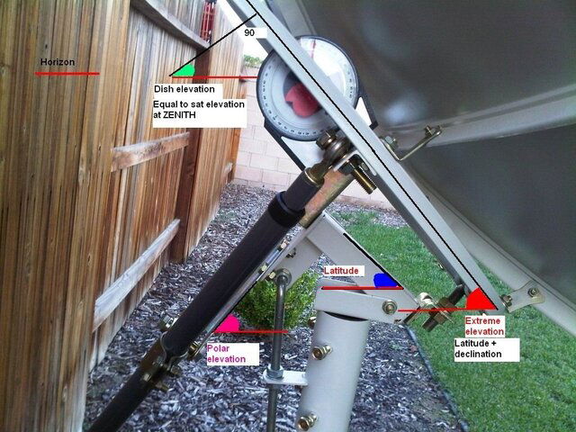
OK. Apparently they're showing 2 sets of declination tables. One for a standard polar mount and the other for a modified polar mount. That's where I got confused. The formula that I used to calculate declination was for a standard polar mount - I don't see anything in the books appendix for a modified polar mount formula. I'm glad I picked up your posts before running out to change the declination angle.Anyway, I checked the declination using an inclinometer (per Paraclipse manual instructions) and it's around 5.6.
Thanks everyone!
If you read through this, it does not refer to two different mount types but rather the difference between calculated dec angles (we used to call the "look angles") and the dec angle that yields the best results (therefore "modified")
In summary, the declination angle lowers the satellite antenna from looking into deep space
to look at the arc of geostationary satellites. However, upon
practice, it has been discovered that using the latitude as the
elevation angle, (first chart below),
the satellites at the top of the arc, in a tracking mount system,
were in perfect alignment with the satellite dish, i.e. were
tracked perfectly by the polar mount, whereas the satellites
at the lower ends of the arc where not tracking correctly. Conversely,
if the satellites at the ends of the arc, on the horizon, were
tracking correctly then the central satellites, at the top of
the arc would be slightly off target. This effect is caused by
the slight deviation from the true north/south line, caused by
the act of the tilting of the dish, as the dish moves to view
satellites lower on the arc, i.e. closer to the horizon. With
this in mind, it was formulated the elevation/declination angles
of the modified polar mount (second chart
below) whose application has no effect on seeing satellites
at the top of the arc but has the effect of better tracking on
the sides and low end of the arc. This effect is accomplished
by slightly increasing the elevation angle and accordingly slightly
decreasing the declination angle by the same amount. Use elevation/declination
settings from the modified polar mount
chart (second chart below) when installing and adjusting
your polar mount tracking system - compare the values of the
two charts below to see the difference in elevation and declination
angles. Note: Elevation and declination angles are always
measured and applied when the dish is at its zenith, i.e. highest
point in the arc, when the dish axis is aligned along the true
north-south line. (Applying
declination/elevation angles.)


