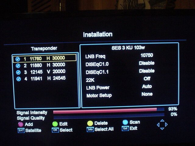
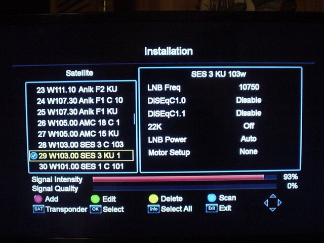
Hi all. If you are reading this post, thanks. I'm new to this satellite stuff and not 100% sure what I am doing.I installed a 33" dish and 10750 ku lnb. When I first installed it I had an Ibravebox v7 sat finder. I was able to pick up a few satellites with the setup I had until I did a firmware update. I had the dish on SES3 and after I did the update it was gone. Tried for days to get it back with no success. Didn't matter what I did. Bought an analogue meter and another box. GTmedia v7s.Now I have a great signal but no signal quality.What am I doing wrong.Thanks in advance.
good signal strength no signal quality
- Thread starter stinkygopher1
- Start date
- Latest activity Latest activity:
- Replies 17
- Views 8K
-
Thank you for a great 2025 and we are so looking forward to 2026! PLEASE CLICK HERE to find out about some of our plans for 2026 including our BRAND NEW NAME we will be moving to in 2026! Exciting times are ahead! Happy New Year from your friends here at SatelliteGuys.US!
You are using an out of date browser. It may not display this or other websites correctly.
You should upgrade or use an alternative browser.
You should upgrade or use an alternative browser.
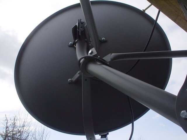
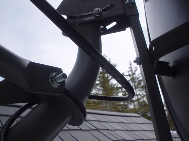
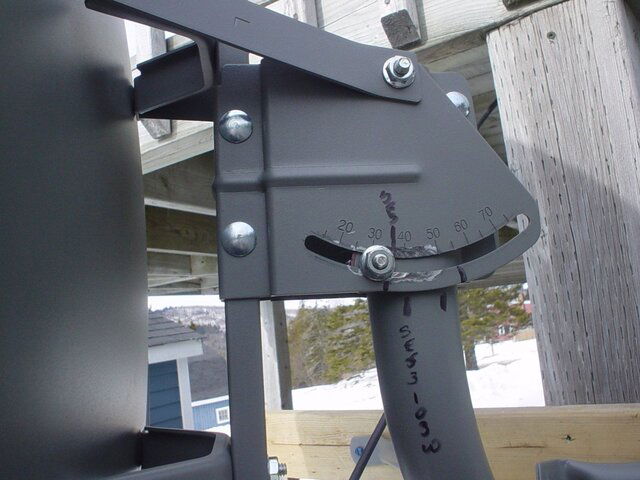
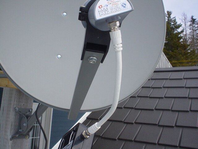
It might help if you could take a few photos showing the STB menu settings. A wide shot of the dish from the side and from behind. A close-up of the LNBF, elevation bracket, etc.
Good Signal level indicates that a powered LNB is attached. The lack of Signal quality could indicate many things:
1. Not aimed at a satellite
2. Aimed at wrong satellite.
3. Not on an active transponder for the target satellite.
4. Incorrect transponder parameters.
5. Incorrect LO frequency selected.
5. LNBF skew angle is not at correct rotation.
6. Unprogrammed Switch inline
I am sure that I am missing a few other possibilities... Good Luck!
Sorry to hear of you troubles. If the only thing you did was a firmware update I'd suspect the update as the culprit. Check all your parameters such as LO (as per Titanium), satellite longitude, make sure your LNB is turned on in the software. Have you performed a blind scan to see if you are receiving any FTA transponders for SES3? I am not familiar with that GTMedia receiver though...does it even support the correct video format for FTA? It rates a 3.4 out of 5 on Amazon, not a good sign. You might want to invest in a better STB (set top box). Good luck and check back with us.
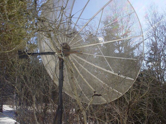
Thanks spongella. I hope to be able to get this all sorted out soon because I found a 10 ft aluminium mesh dish the other day in very good shape and I want to be able to get it home and set up in the spring.It's all intact and hidden from the wind and weather by the trees that grew up around it.Even got for nothing so the price was right. I will get some pictures and post them when I go back town to start removing it. I hope to be able to bring it home in one piece. It's only a couple of miles down the road.
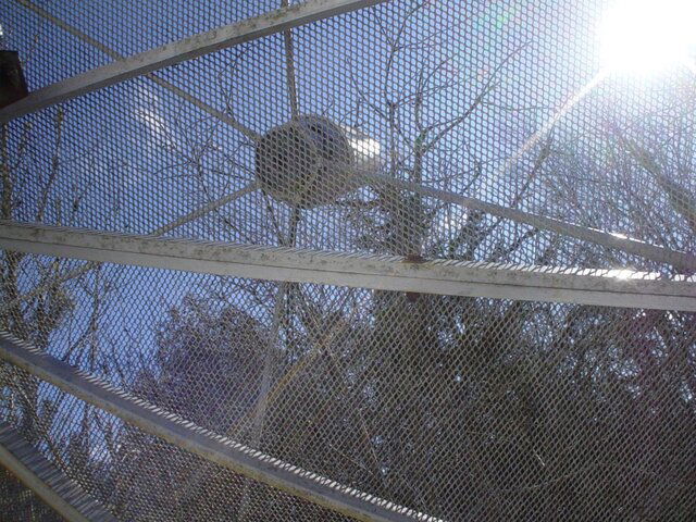
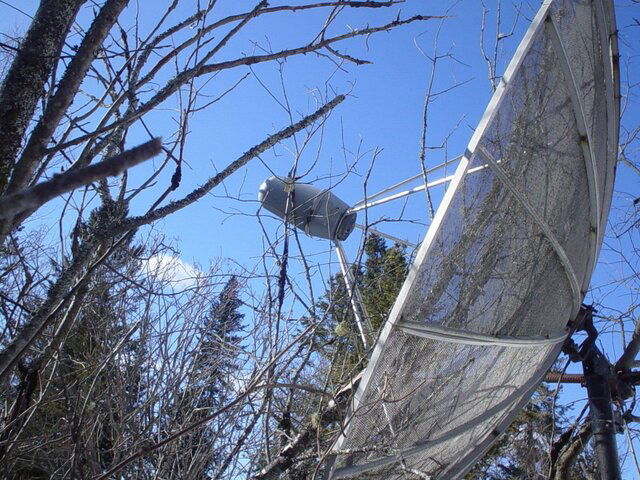
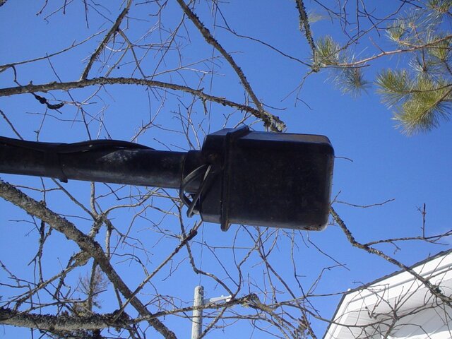
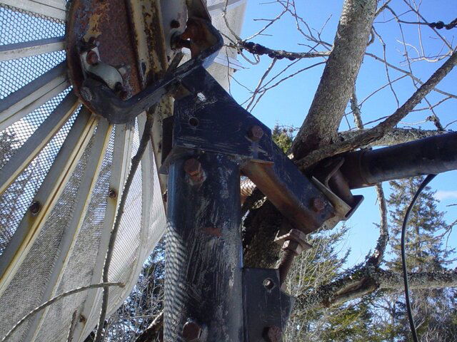
These are some pictures of the 10 foot dish I got for nothing.Needs some work but the price was right.Not sure what make it is and I didn't see any info on it.It's only down the road a few miles so getting it home shouldn't be a problem.Getting it out of the trees might be.
Attachments
In regards to your Ku dish setup, looks like you need to re-point your dish. Don't go by the signal intensity, adjust for the best signal quality.
Taken from Dishpointer.com for your approx. install location aiming at 103w.
Your Location: Saint John, NB, CA
Latitude: 45.2733°
Longitude: -66.0633°
Satellite Data
Name: 103W SES-3
Distance: 38937km
Dish Setup Data
Elevation: 26.4°
Azimuth (true): 226.6°
Azimuth (magn.): 243.4°
LNB Skew: 30.8°
Looking at the photos, i cannot tell if the mast is PERFECTLY plumb? If not, the elevation scale readings will not be correct and aiming will be very difficult. If it isn't PERFECTLY plumb, take a few minutes to make sure it is plumb fore/aft and side to side.
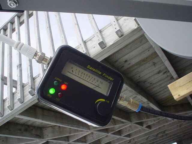
Do you have the TV outside at the dish so you can observe the Signal Quality meter reading as you SLOWLY pan the dish? If not, get the TV next to the dish. The analog meter only tells you when the dish is aimed at a satellite and nothing about if it is the correct satellite or the Signal Quality for optimizing or adjusting the LNBF skew. You must be viewing the Signal Quality meter reading to locate, aim and optimize.
The face of the offset dish should be almost vertical when aimed at at satellite of 26 degrees elevation. The photo of the elevation scale shows an incorrect elevation angle for 103w at your location. The dish is aimed too high. My guess is that you are aimed at a high powered DirecTV satellite a little further to the East.
The LNBF rotation (Skew) does appear to be 31 degrees. Looks more like 20 degrees or less? Could be the angle of the photo.
From the reading on the analog meter, the dish is aimed at a satellite, but not 103w satellite.
The 11760 transponder on 103w satellite may be more difficult for you to lock especially in NB, Canafa and should instead locate the 103w satellite using a stronger transponder of 12145 V 20000.
Even better, instead first time finding a satellite, aim at a satellite closer your longitude, like SES2 at 87w transponder 11811 H 11150.
Here is the dish aiming coordinates for 87w from your approx location in NB:
Your Location
Latitude: 45.2733°
Longitude: -66.0633°
Satellite Data
Name: 87W SES-2
Distance: 38277km
Dish Setup Data
Elevation: 33.9°
Azimuth (true): 208.3°
Azimuth (magn.): 225.2°
LNB Skew: 19.5°
Another better first satellite to aim at that has a good signal footprint in your region would be 97w, Galaxy 19, transponder 12152 H 20000
Aiming coordinates:
Your Location
Latitude: 45.2733°
Longitude: -66.0633°
Satellite Data
Name: 97W GALAXY 19 (G-19)
Distance: 38652km
Dish Setup Data
Elevation: 29.6°
Azimuth (true): 220.1°
Azimuth (magn.): 237.0°
LNB Skew [?]: 27.0°
Hope this helps. Patience and a TV at the dish will pay off!
Thanks Titanium. I have a question about the elevation guide on the side of the dish.Is the scale on the side mostly accurate because if I put an angle meter on the arm it is different from the scale on the side. I had it sighted in once before on SES3 but maybe it was beginners luck.Thanks for all the comments and help!
Stamped scales on the elevation bracket will get you into the ballpark range. On some dishes, the stamped scale is extremely accurate, while on other models, the scale is useless.
An offset dish should have the offset degrees listed in the product specifications. Typical range off the offset is between 23 and 26 degrees. This means that if the face of the dish is vertical (0 degrees) the dish is actually aimed at a point 23 to 26 degrees higher above the horizon
The arm angle is not usually the same angle as the offset angle (or listed in the specs), so it cannot be used until you can locate the first satellite and determine the difference between the offset angle and the dish arm angle. Once you know the difference, then the arm can be approximately set for the calculated angle for the target satellite elevation.
Thanks again. I found the specs on the dish. So if I want to aim it at 26.1 degrees do I have to factor in the offset angle?
Model:33″ Dish With Mount
75cm (33″) offset dish antenna with role-in
edge and powder coating finish.
Model:33″ Dish With Mount
75cm (33″) offset dish antenna with role-in
edge and powder coating finish.
- Using professionally designed software and precisely engineered reflectors with CAD/CAM for processing
- Exceptional wind load resistance with a strong dish supporting structure
- Manufactured by galvanized steel and finished with a powder coating for superior corrosion resistance
- Anti-corrosion finish for a longer life span
- adjustable EL/AZ mounting bracket to suit various sizes of mounting poles
- Designed for a simple and stress-free installation
- Brand: Digiwave
- Satellite Dish Type: Offset
- Colour: Grey
- LNB: Ku Band
- Mounting Type: Pole/Ground/Wall
- Material: Steel
- Finish: Polyester Powder
- Pole Diameter: 38 to 50mm
- Offset Angle: 22.75
- Focus Length : 49.2 cm
- Aperture Short Axis: 75 cm
- Aperture Long Axis: 81.3 cm
- LNB Gain : 12.5GHz 38.63dB
- Elevation: 10° to 90°
- Azimuth : 0° to 360°
- Efficiency : ?70%
- Ambient Temperature: -40°C to +60°C
- Relative Humidity : 0 to 100%
- Height of the product (in): 38
- Width of product (in) : 33
- Depth of product (in): 25
- Product weight (lb) : 14
From the specs you know that the Offset Angle is 22.75. Here is a method if you want to know what elevation the dish is aimed, without having to trust that the pole is plumb on all sides and the elevation scale stamping is correct.
Place a straight edge on the vertical axis of the dish (on the rim of the dish at the 12 o'clock and the 6 o'clock positions). Place your angle finder on the straight edge. The dish is pointed at an elevation that is 22.75 degrees higher than the angle finder reading. Example: If the angle finder displays 10 degrees, the dish is actually aimed at 32.75 degrees (10 + 22.75 = 32.75). We call this the look angle of the dish.
If you know that the dish is pointed at a look angle of 32.75 degrees elevation, place the angle finder on the LNBF support arm and see what elevation angle is displayed. Example: If the Angle Finder on the arm displays 30 degrees, you know that you will need to add 2.75 degrees to the arm elevation reading to calculate the look angle of the dish.
Likely you will find that these settings closely match the stamped Elevation Scale on the mount as long as the mounting post is plumb.
Well thanks for all the great advice and help.I now have it back on SES3.There is a steep learning curve for this satellite setup stuff. To go from watching tv to learning how it gets in your tv is a trip.Thanks again Brian for the great help!!
Brian knows his stuff! Bigest mistake people make is taking big steps before the baby steps. You have no idea how many people I have seen swing the dish 5 or 6 degrees at a time and do not know why they cant find a signal. Glad you locked some thing finally.
Thanks to everyone! Now on to the big one.Can't wait to get the 10 ft home and get it working.I'll be back!
The best advice I can give here is that you don't rush... Now that you got 103W, explore a bit more with that dish.. You should be able to get 97W, 95W, 91W, 87W, maybe 30W and even 15W. Also worth trying are 123W and 125W but that might be quite low in the west since you're quite far East. Anyway, spend some time exploring, getting a good feel for what you're doing and how it works.Thanks to everyone! Now on to the big one.Can't wait to get the 10 ft home and get it working.I'll be back!
Reception with a 10ft dish is definitely interesting and there's a lot more (for now...) on C-Band than in Ku. But the installation is a much bigger project and you need to spend time on site survey, so that you place the dish at the best possible location. You don't want to set a pole in 1000 Lbs of concrete to realize that you have a building blocking the line of sight... You also need to make sure the actuator is in working condition, and that you have something to control it.
Never hesitate to ask questions here, we're all more than happy to help answer them!
Similar threads
- Replies
- 6
- Views
- 751
- Replies
- 6
- Views
- 814
- Replies
- 9
- Views
- 1K
- Replies
- 2
- Views
- 809
- Replies
- 5
- Views
- 283


